I combined maps, analysis and on-the-ground reporting to explain why a flood-control project became immensely controversial in Denver — and to provide realistic answers to residents’ fears.
It would start in the streets, water beading together on the pavement of Park Hill and sloughing into the gutters and underground pipes. It might take an hour before the drains beneath the pavement were full.
Soon, Leetsdale Drive would become a curving funnel, driving water down toward the open fields of City Park, where it would pool into a lake and then escape downhill. With no natural route to escape from northeast Denver to the South Platte, the floodwater within hours would make a river through the neighborhoods, piling higher and faster as it crashed into the valley.
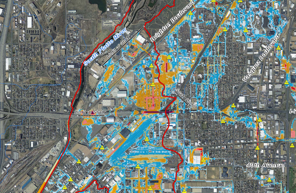
“You would have high velocity of water, six feet in depth or greater,” said Jenn Hillhouse, a project engineer for the city. She was describing the 100-year flood, a theoretical catastrophic event that would send a crush of water flooding into low-lying neighborhoods and straight across the path of Interstate 70.
City engineers say that one of Denver’s hottest redevelopment zones would be swamped in a matter of hours by a flood of this size. Nearly $300 million of new pipes, channels and wetlands are supposed to safeguard the city against this scenario, according to city engineers.
The trouble is, not everyone believes them.
Read the full piece at Denverite.